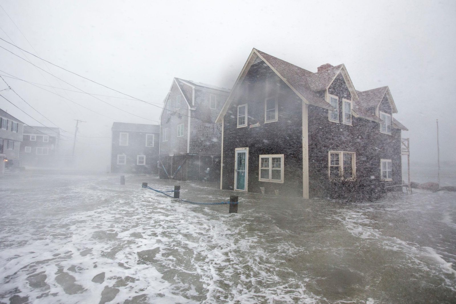
A potentially powerful late-September nor’easter is developing near the U.S. East Coast, raising concerns about strong winds, heavy rain, high surf, coastal flooding and beach erosion. The storm is still developing, and its exact track will determine how severe the impacts become.
The National Weather Service’s Weather Prediction Center says an impactful coastal storm could meander near the Mid-Atlantic and Northeast later this week and into the weekend. Strong onshore winds could continue for several days, increasing the risk of coastal flooding, dangerous surf, rip currents and beach erosion.


6
A Rare September Nor’easter Is Taking Shape
Nor’easters are generally associated with the colder months, but weather models are now showing the potential for a significant coastal storm during the final week of September.
According to recent reporting, the developing system could intensify off the Mid-Atlantic coast and affect a large section of the Eastern Seaboard. The Washington Post reported that the storm could bring heavy rain, gusty winds, rough seas, coastal flooding and beach erosion, although its eventual strength depends heavily on how close it tracks to the coastline.
This uncertainty is important because a storm that stays farther offshore could produce substantially different impacts from one that moves closer to the coast.
Could Winds Reach 70 MPH?
One of the biggest concerns is the potential for powerful wind gusts.
Some forecast scenarios have suggested 60–70 mph winds, particularly along exposed coastal areas. However, these higher wind speeds should not be treated as a confirmed forecast yet.
The National Weather Service currently emphasizes a prolonged period of gusty northeast winds and ocean gales, with the storm’s eventual track remaining an important factor in determining the threat to land.
That means residents along the coast should watch updated forecasts rather than relying on a single early model prediction.
Coastal Flooding Could Become a Major Problem
Flooding may be one of the most important impacts from this storm.
Persistent winds blowing toward the coast can push ocean water toward beaches, bays and inlets. When this happens during high tide, water levels can rise enough to flood roads, low-lying neighborhoods and coastal properties.
The National Weather Service says the combination of northeast winds, rising astronomical tides and building seas could result in multiple episodes of minor to localized moderate coastal flooding in parts of the New York region.
The timing is particularly important because the full moon is expected on September 26, which can contribute to higher astronomical tides.
High Waves and Beach Erosion
Another major concern is the ocean.
Strong onshore winds can generate large waves and powerful surf. These conditions can produce dangerous rip currents and accelerate beach erosion.
The NWS forecast discussion already highlights the potential for high surf, dangerous rip currents and beach erosion along with coastal flooding.
Beaches, barrier islands and exposed coastal communities could therefore experience impacts even if the storm’s center remains offshore.
Which Areas Could Be Affected?
The potential threat extends across parts of the Mid-Atlantic and Northeast, although the exact areas facing the strongest impacts are not yet certain.
Depending on the storm’s eventual track, coastal areas from the Carolinas through the Mid-Atlantic and toward New England could experience periods of strong winds, heavy rain, rough surf or flooding.
The National Weather Service in the Philadelphia region is also monitoring the development of a strong coastal low offshore during the middle and latter parts of the week, with the potential for heavy rainfall, strong winds and coastal flooding along the East Coast.
Why the Forecast Is Still Uncertain
The storm is not yet fully developed, so meteorologists are still watching how several weather systems interact.
The position and strength of the upper-level low, the coastal low and high pressure to the north will influence the eventual storm track.
A storm that remains farther offshore could mean less severe conditions on land. If it tracks closer to the coast and strengthens, however, the combination of wind, waves, rainfall and high tides could produce more significant coastal impacts.
This is why current forecasts should be treated as evolving rather than final.
What Residents Should Watch
People living near the East Coast should monitor updates from the National Weather Service and local emergency officials as the storm develops.
Important hazards to watch include:
- 🌊 Coastal flooding
- 💨 Strong or damaging wind gusts
- 🌧️ Heavy rainfall
- 🌊 High surf and large waves
- 🏖️ Beach erosion
- ⚠️ Dangerous rip currents
- 🚗 Flooded coastal roads
- ⚡ Possible power disruptions
Residents in flood-prone coastal locations should avoid driving through flooded roads and should secure loose outdoor objects before stronger winds arrive.
Bottom Line
The developing September 2026 nor’easter could become a significant East Coast weather event, but the final intensity and location of the strongest impacts are still uncertain.
Forecast guidance currently points toward a prolonged period of gusty winds, rough seas and coastal flooding potential. Some scenarios have suggested 60–70 mph gusts in exposed coastal locations, but those higher-end numbers are not yet a confirmed land forecast.
The next several forecast updates will be especially important because even a relatively small change in the storm’s track could significantly change the impacts along the coast.
About the Author